Architectural heritage
World Heritage Sites
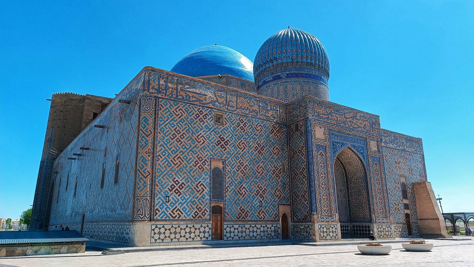
Khoja Ahmed Yasawi Mausoleum
Type: national single
Год включения: 2003
The mausoleum is an outstanding monument of Timurid architecture, the construction of which was carried out in 1389-1405 by order of Amir Timur. This monumental structure was erected over the tomb of the outstanding Sufi poet and preacher Khoja Ahmed Yasawi, who lived in the 12th century. The best Persian masters were involved in the implementation of the project, who applied innovative architectural and engineering solutions that were later used in the construction of other objects in Samarkand, the capital of the Timurid Empire.
The complex includes many rooms, including a central hall with a huge dome, a mausoleum, a small mosque, a library and a refectory. The dome of the main hall, which is considered one of the largest in Central Asia, is especially impressive. The interiors of the mausoleum are richly decorated with tiles, mosaics and calligraphy, making it a striking example of the decorative art of the era.
The mausoleum is highly preserved and is an exceptional example of the development of Islamic architecture in the region. Its significance goes beyond its architectural value - it serves as an important cultural and spiritual center, attracting pilgrims and researchers from all over the world. In 2003, the mausoleum was added to the UNESCO World Heritage List as one of the most significant monuments of Islamic architecture in Central Asia.
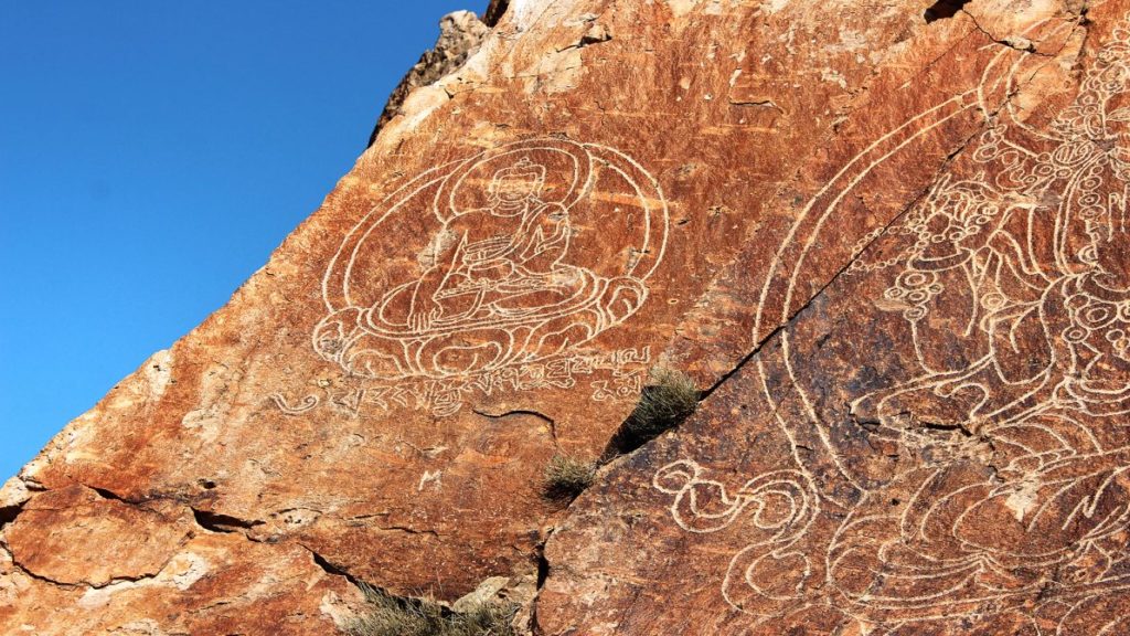
Petroglyphs of the Tanbaly Archaeological Landscape
Type: national single
Year of inclusion: 2004
A unique cluster of rock art, including about five thousand petroglyphs, has been recorded in the Tanbaly tract, located in the foothills of southeastern Kazakhstan. These images cover a long period - from the middle of the second millennium BC to the beginning of the 20th century. Hunting scenes, cult rituals, images of anthropomorphic and zoomorphic creatures are depicted on the stones, which allows us to trace the evolution of the artistic and religious ideas of the ancient societies of the region.
In addition to the rock art, various forms of burials have been discovered on the territory of the monument: stone cists-cists, typical of the Bronze Age, as well as numerous burial mounds, the construction of which continued from the early Iron Age until recent times. These archaeological objects indicate the long-term use of this area as a sacred space. The central zone of Tanbaly is particularly notable for its high density of petroglyphs and the presence of objects that are interpreted as altar sites. This gives grounds to assume that it was here that the most important religious and ritual actions took place, including sacrifices. Currently, the Tanbaly tract is considered one of the most significant cultural landscape zones of Central Asia. It is an important source of knowledge about the spiritual and everyday life of the ancient peoples who inhabited this territory for thousands of years.
Silk Road: Chang'an-Tianshan Corridor Route Network
Type: serial transnational (shared with China and Kyrgyzstan)
Year of inclusion: 2014
This object consists of 33 component parts located along a 5,000 km stretch from Chang'an/Luoyang, the central capital of China during the Han and Tang dynasties, to the Zhetysu region of Central Asia. It was formed between the 2nd century BC and the 1st century AD. and was used until the 16th century, linking many civilizations and facilitating extensive exchanges of trade, religious beliefs, scientific knowledge, technological innovation, cultural practices and the arts. The component parts represent the capitals and palace complexes of various Han empires and kingdoms, trading posts, Buddhist cave temples, passes, lighthouse towers, sections of the Great Wall of China, fortifications, tombs and religious buildings. There are 8 component parts of the World Heritage site in the Republic of Kazakhstan:
The Kayalyk settlement
The Kayalyk settlement was located within the Ili Valley and occupied a strategically important position at the intersection of trade routes that were part of the Great Silk Road. During its heyday, it was a dynamic trade and craft center that attracted merchants, pilgrims, and travelers from different parts of Asia and even Europe.
Archaeological research indicates a high level of development of the settlement: even in those days, there was a well-thought-out water supply system, including elements of a water supply system, which speaks of developed engineering and urban culture.
Kayalyk was distinguished by its diversity of cultures and religions. Representatives of various religious traditions peacefully coexisted there - Islam, Christianity, Buddhism, Manichaeism, and shamanism. This makes Kayalyk a symbol of religious tolerance and intercultural dialogue, a rare example of a harmonious social structure in the conditions of the medieval East.
Talgar Settlement
The Talgar Settlement, dating back to the 8th–14th centuries, was located at the foot of the Zailiyskiy Alatau and played an important role in the trade network of the Great Silk Road. Archaeological finds, including ceramics, glass, coins and other artefacts brought from China, Iran, India and Japan, confirm the city’s active participation in international trade. These items testify not only to economic ties, but also to the high level of material culture of the local population.
Talgar is a striking example of the development of an urban settlement in an agricultural context. Its economy was based on a combination of handicraft production and agriculture, which ensured the stability and prosperity of the city for several centuries. The layout, remains of dwellings and irrigation structures reflect the adaptation of urban life to an agricultural environment.
Edit
Aktobe Settlement
The Aktobe Settlement was a significant trading and cultural settlement that played an important role in the dissemination of religious and social ideas in the region. Founded in the 6th century AD as a result of the interaction of the nomadic tribes of Zhetysu with local settled communities, it became an example of a successful synthesis of nomadic and agricultural cultures.
Thanks to fertile lands and a favorable location, Aktobe turned into a prosperous settlement that existed for seven centuries. During this period, the territory of the settlement saw the active spread of Islamic and Christian traditions, which indicates intercultural contacts and religious tolerance.
The fortification system of the settlement was represented by two outer walls enclosing the settlement along the perimeter. The archaeological structure includes two citadels, two shakhristans and a rabad - a residential and craft part outside the main fortifications. Additional protection was provided by three castles, strategically located: one in the southern part of the settlement, two in the north.

Kulan Settlement
The Kulan settlement arose in the 6th century AD. and over time turned into a significant trade and administrative center. Its development is closely linked to the vast agricultural territory surrounding the settlement: the agricultural oasis covered about 50 square kilometers, providing a stable supply of food and resources. Kulan was distinguished by a well-thought-out defense system. Its fortifications included massive walls and castles, which provided protection from external threats and emphasized the strategic importance of the settlement on the routes of the Great Silk Road. Despite the strong influence of Islam, especially starting from the later stages of the city's existence, elements of Zoroastrian, Tengrian and shamanistic traditions were preserved in the cultural and religious life of Kulan. This testifies to the diversity of spiritual practices and religious tolerance characteristic of this region in the early Middle Ages.

Ornek Settlement
The Ornek settlement was an important trading center, the development of which was due to its advantageous geographical location. It was located at the junction of the desert plain and the foothills of the Kyrgyz Alatau, near the Altynsu and Shybyndy rivers. These waterways provided not only fresh water, but also served as sources of gold, which significantly contributed to the economic prosperity of the settlement.
Ornek's proximity to the Chang'an-Tian Shan Corridor, one of the main routes of the Great Silk Road, increased its importance as a hub of international trade. It was due to the combination of natural resources, access to water and a strategic position in the trans-Asian trade network that Ornek became an attractive place for merchants, artisans, travelers and settlers from various regions of Asia.
Thus, Ornek is an example of how geography and resources formed stable centers of trade and intercultural interaction in medieval Central Asia.

Akyrtas Settlement
The Akyrtas architectural and archaeological complex, dating back to the 8th–14th centuries, is a unique ensemble of structures located at the foot of the Kyrgyz Alatau. It is not a settlement in the traditional sense, but rather a monumental architectural object associated with the ancient settlement of Kasribas and included various functional buildings.
The complex consists of a palace building, a ruler’s castle, fortification elements, a caravanserai, residential estates, a watchtower, reservoirs (khauzes), a park area, and quarries where building materials were mined. In addition, Saka burial mounds and the remains of an ancient irrigation system were discovered on the territory of the complex, indicating a long-term and multifunctional use of this area.
According to archaeological research, in the 8th–9th centuries, the residence of the Karluk rulers was located here, indicating a Turkic presence. However, the greatest flourishing of the complex as an important point on the region's trade routes occurred between the 11th and 14th centuries. Due to its advantageous location and developed infrastructure, Akyrtas played a significant role in the economic and political life of Medieval Central Asia.

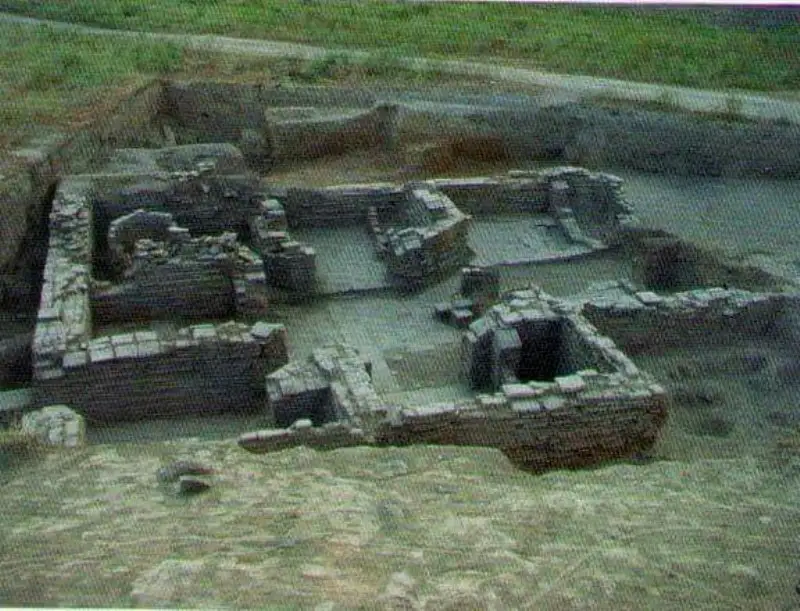
Kostobe Settlement
The Kostobe Settlement, dating back to the 6th–12th centuries, is located on the right bank of the Talas River and is a complex of free-standing hills of various shapes and sizes. Its topography is similar to the layout of other ancient settlements in the Chui Valley, such as Ak-Beshim, Suyab, and Nevaket, indicating the general principles of urban development in the region in the early medieval period.
According to archaeological and written sources, Kostobe is identified with the ancient city of Dzhamukat (or Hamukat), founded in the 6th century by the Sogdians who moved here from Bukhara. This city occupied an important place in the system of trade and cultural ties in Central Asia. It is mentioned by such authoritative sources as the works of the geographer al-Maqdisi of the 10th century and the historical and geographical work "History of Bukhara" by an-Narshahi. Jamukat was well fortified: the city was surrounded by massive walls and defensive ditches, which ensured the safety of both its residents and merchants passing through the region. The use of the waters of the Talas River for irrigation of fields and accumulation of water reserves allowed for the effective development of agriculture, which, in turn, contributed to the prosperity and sustainable development of the city center.

The Karamergen settlement
The Karamergen settlement, which existed from the 9th to the 13th centuries, is the northernmost monument of the medieval agricultural civilization in the area of the ancient delta of the Ili River. It was the largest city of the pre-Mongol period in the Balkhash region, playing an important role in the economic and transport system of the region.
Irrigated agriculture was the basis of life for the local residents, but hunting in the tugai forests surrounding the delta was also an important element of the economy. Karamergen was located near Lake Balkhash, approximately three kilometers north of the confluence of the now dry Ortasu and Shet-Bakanas rivers. During the city's heyday, between the 9th and 12th centuries, water resources were abundant, and archaeological evidence indicates the presence of a developed water supply system.
One of the key factors that contributed to the growth of Karamergen was its strategic location: the city was at a convenient point for crossing Lake Balkhash. This crossing significantly shortened the trade route connecting Zhetysu with Eastern Turkestan by almost a thousand kilometers, passing through the territories of modern Central and Northern Kazakhstan. The city fell into decline as a result of the Mongol invasions of the 13th century. The subsequent change in the riverbed led to the drying up of water sources, which finally made the continuation of life in Karamergen impossible, and it was abandoned by its residents.
